Distance: 3.0 miles (one way).
Difficulty Level: easy to moderately difficult. 🟦
Time: 2-3 hours.
Elevation Change: 800 ft./260 ft.
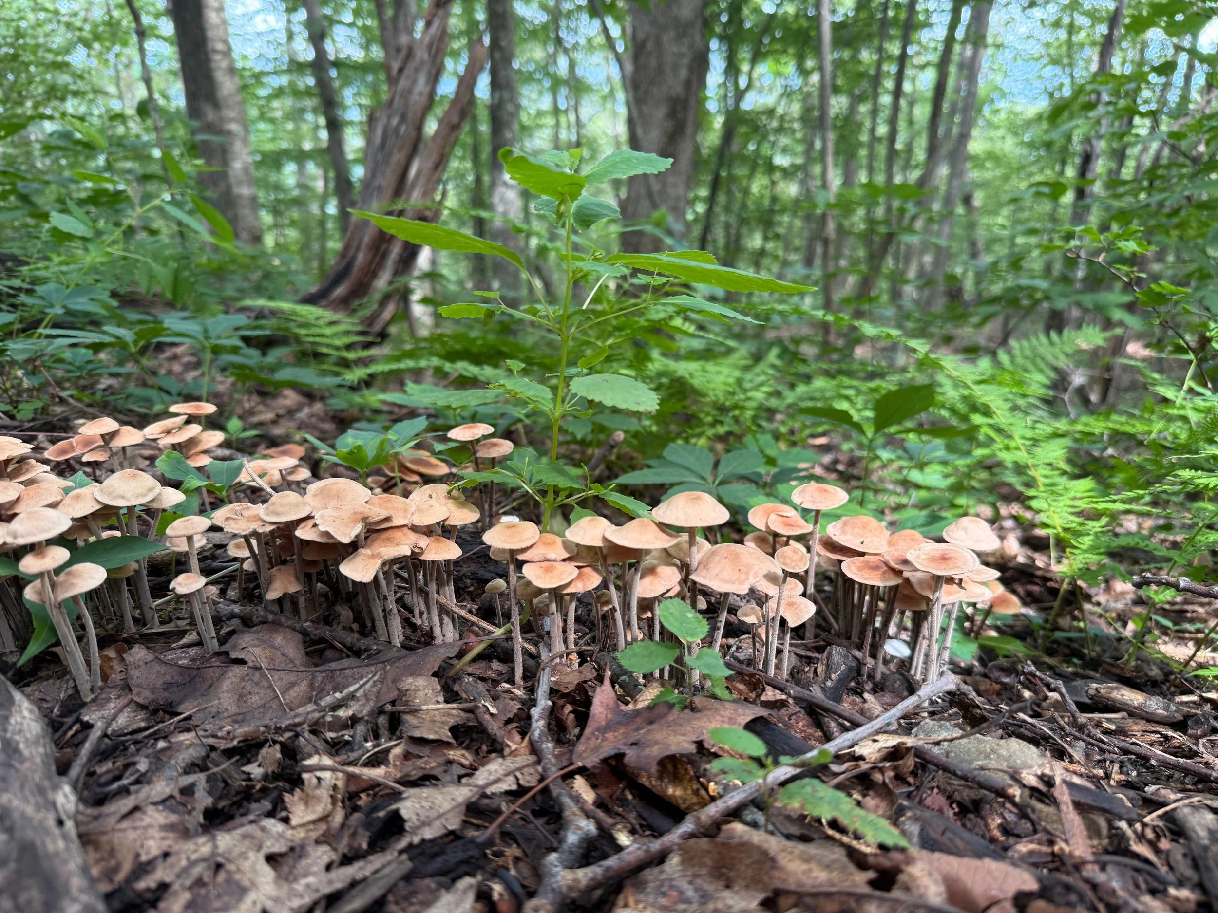
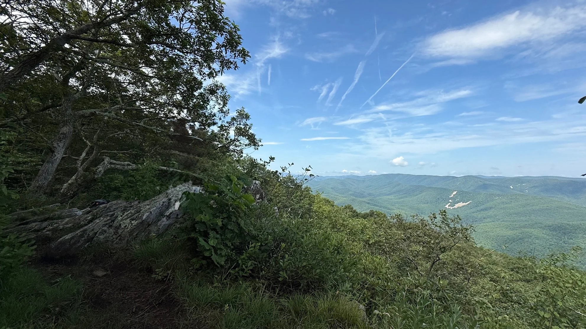
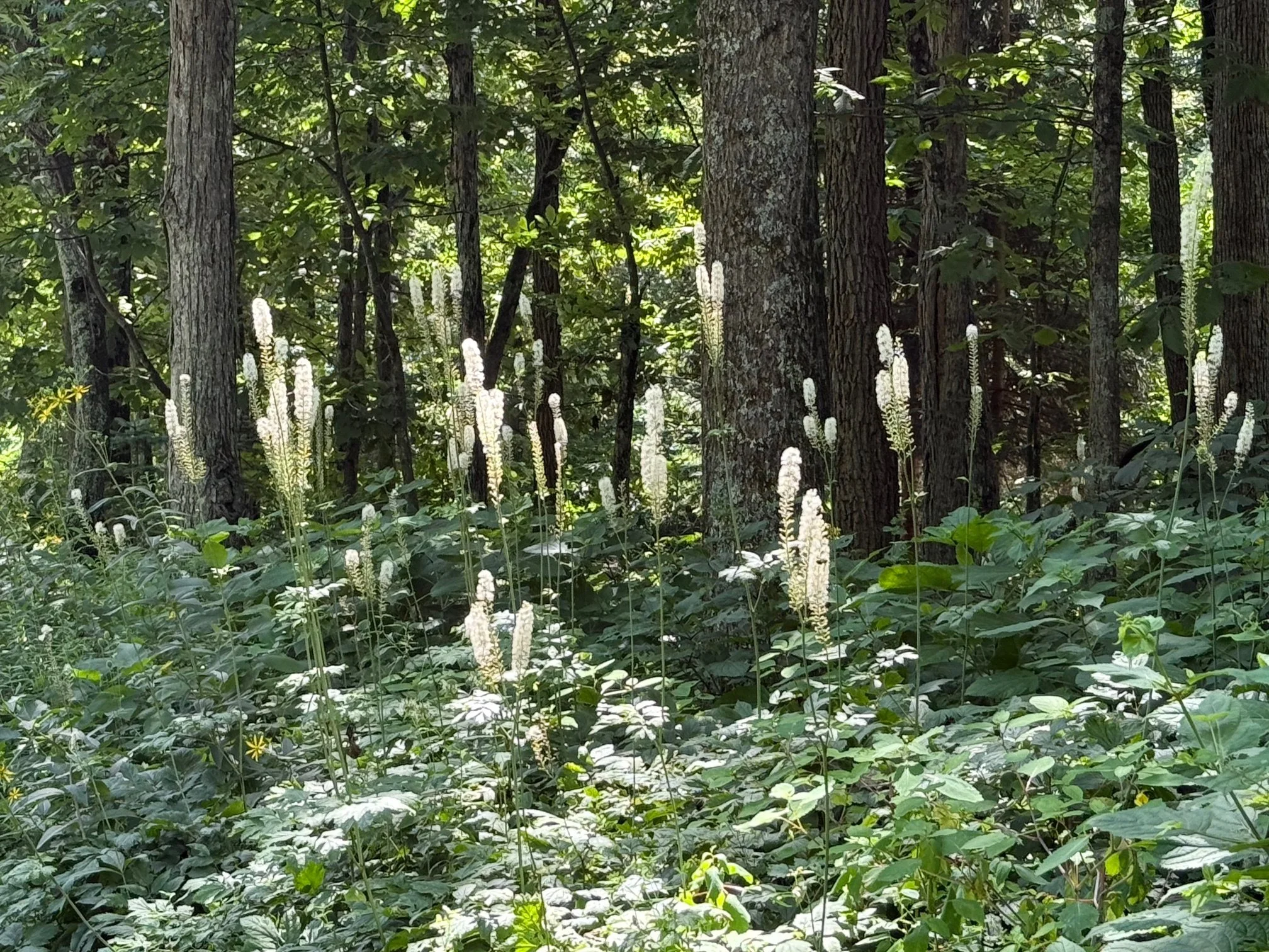
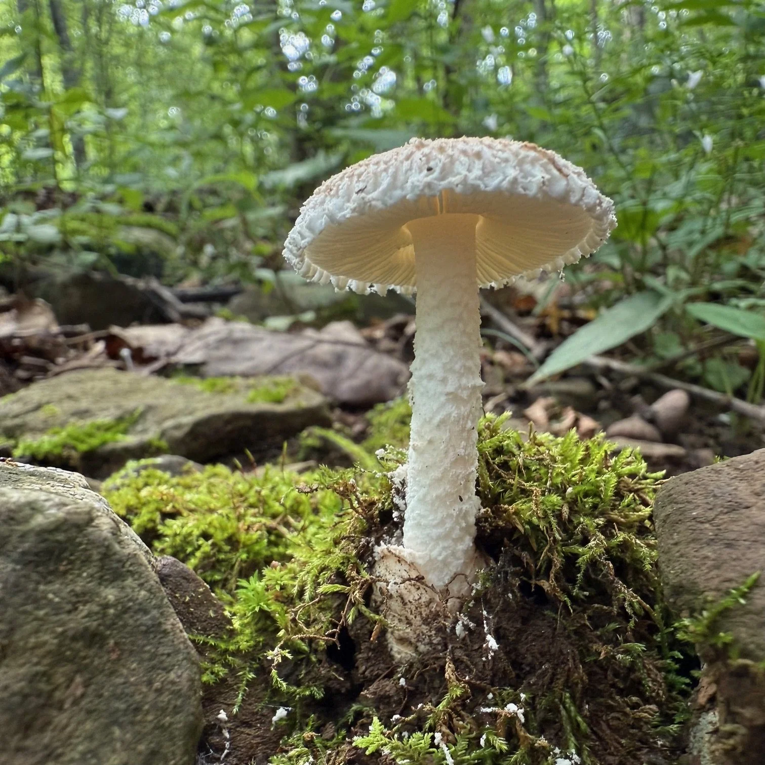
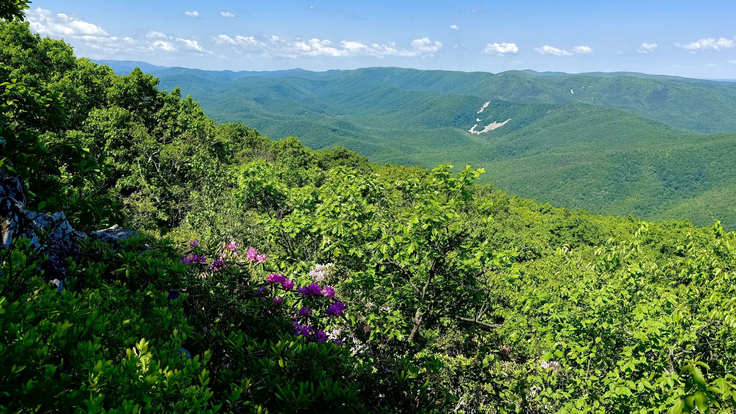
Key Features: rocky, wildflowers, fungi, scenic views.
Blaze Color: red.
Access: The north end is accessed at the Old AT Access on Laurel Springs Road. The south end is accessed on Cedar Drive.
Google Maps directions to parking area at the north end.
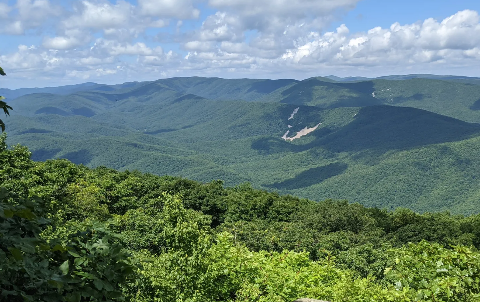
The Old Appalachian Trail at Wintergreen has an array of access points and varying hike lengths. Along the trail there are numerous greenstone ledges that provide spectacular views of the south and the Shenandoah Valley. Wildflowers are abundant in the spring and summer. The trail was once part of the official Appalachian Trail and there is an access trail to the current Appalachian Trail on Laurel Springs Drive near Wolftrap Lane which also connects to the old AT.
Most of the Old Appalachian Trail is rated easy to moderate. However, the southern end of the trail between Cedar Drive and Crab Orchard Lane is rocky and difficult. Use caution in winter.
Additional Hikes: The Shamokin Springs/Old AT Hike is a 2.1-mile out and back hike that goes to a spectacular vista on the Old AT. Details.
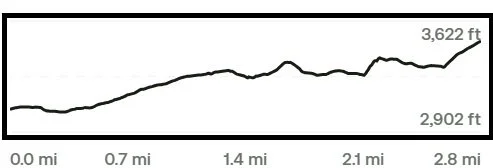
Trail Elevation via AllTrails.com.